Mapping Sciences Institute, Australia Facsimile Maps and Charts
Click to Expand
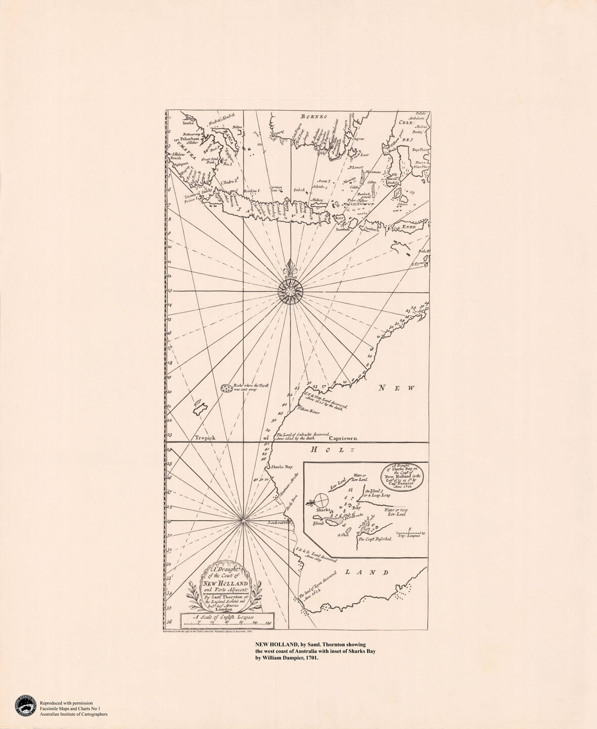
Facimile Maps and Charts No 1
NEW HOLLAND, by Saml.Thornton showing the west coast of Australia with inset of Sharks Bay by William Dampier, 1701.
Click to Expand
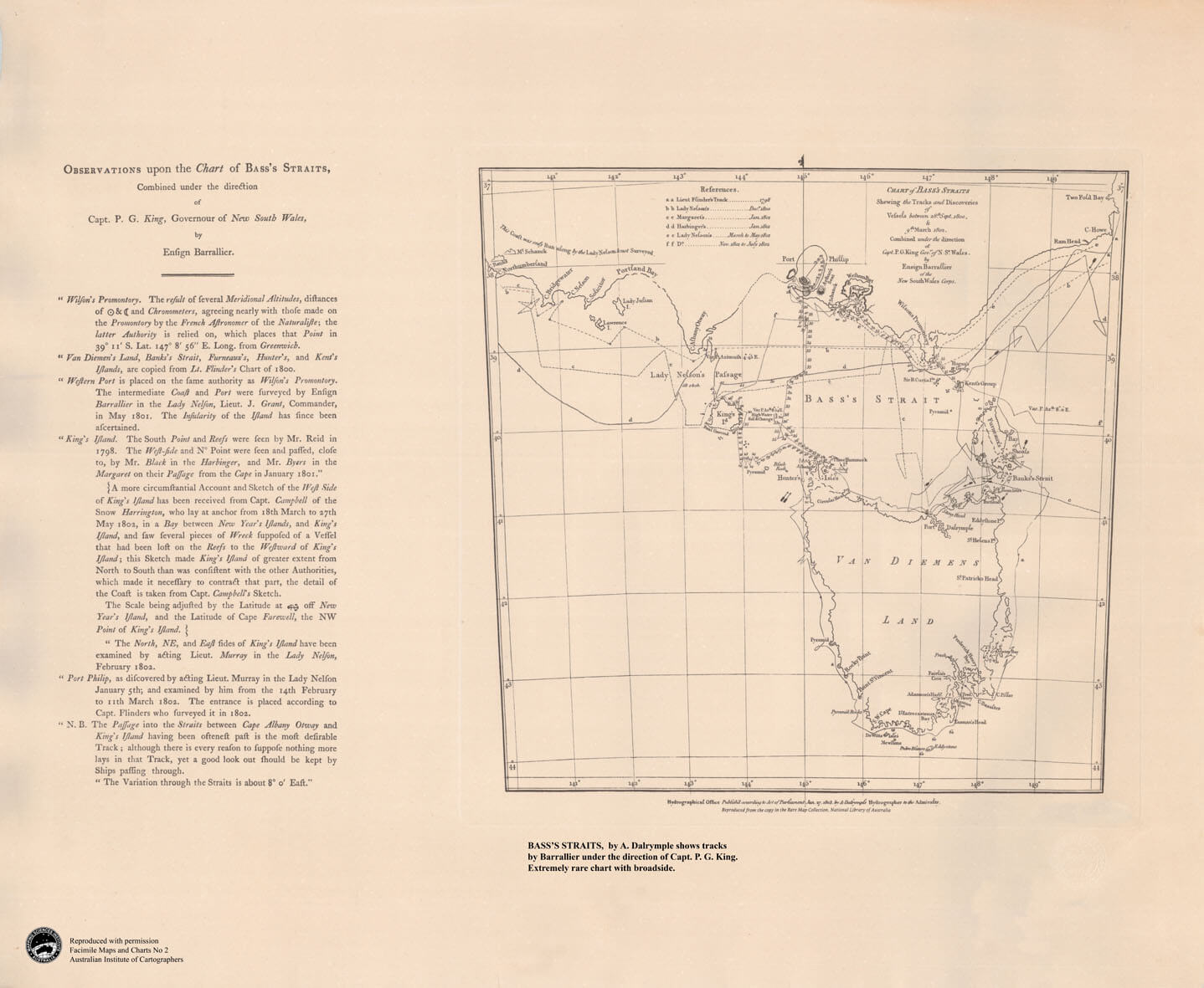
Facimile Maps and Charts No 2
BASS’S STRAITS, by A. Dalrymple shows tracks by Barrallier under the direction of Capt.P.G. King. Extremely rare chart with broadside.
Click to Expand
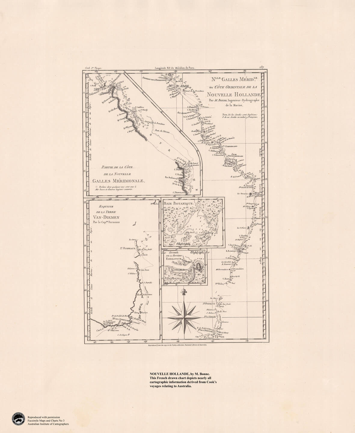
Facimile Maps and Charts No 3
NOUVELLE HOLLANDE, by M.Bonne. This French drawn chart depicts nearly all cartographic information derived from Cook’s voyages relating to Australia.
Click to Expand
Facimile Maps and Charts No 4
COSTA AUSTRALE, by Robert Dudley. Based on information from early Dutch voyages shows the west coast of Cape York Peninsula.
Click to Expand
Facimile Maps and Charts No 5
TERRES AUSTRALES, by J. N. Bellin is based on Tasman and shows Australia pre-Cook with New Guinea, Australia and Tasmania as one continent.
Click to Expand
Facimile Maps and Charts No 6
TASMAN’S VOYAGE, by Francois Valentyn shows the track of Abel Tasman’s voyage in 1642 and includes Van Diemen’s Land and New Zealand.
Download Maps and Charts
These maps are being provided by the Mapping Sciences Institute, Australia and are allowed to be downloaded for free.
Please complete the online order form and after form submission, check your email inbox for confirmation with instructions to download requested files.
The maps are sent in a JPG file format and file sizes range from 10 to 15 mb each.